Civil 3D Infrastructure Project
Project Type
Infrastructure
Project Scope
Topography, Land Fill, Utility Modeling
Software
Civil 3D, Revit, Navisworks
LOD Level
LOD 350
Civil 3D Infrastructure Project
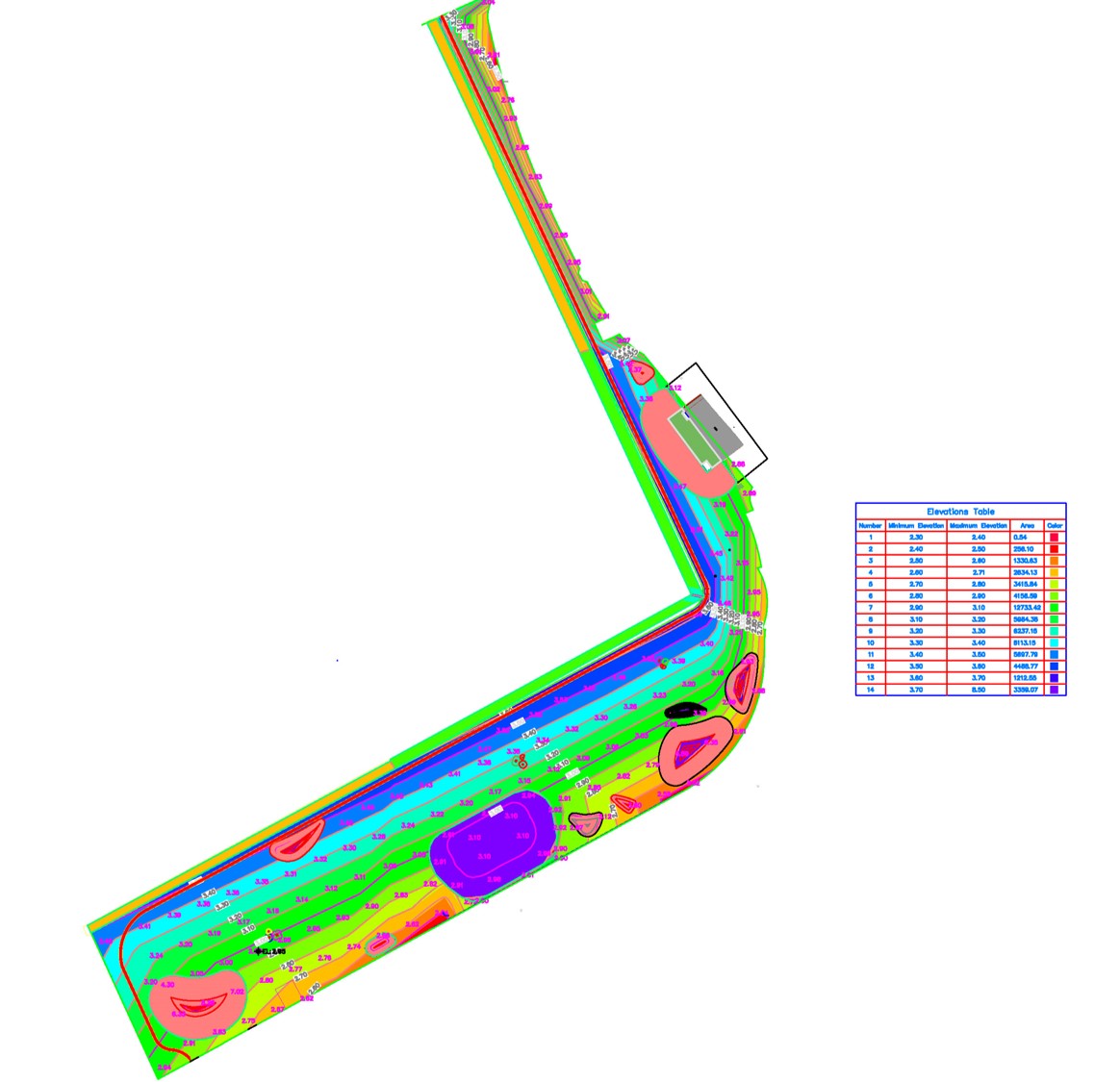
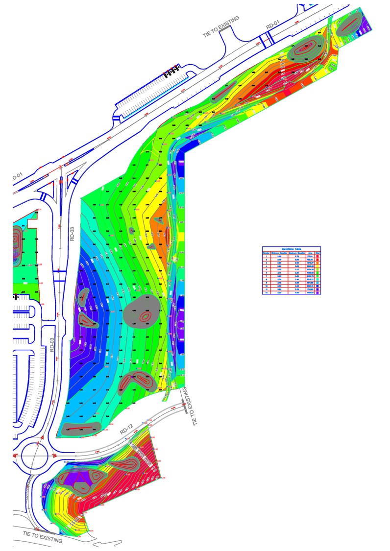
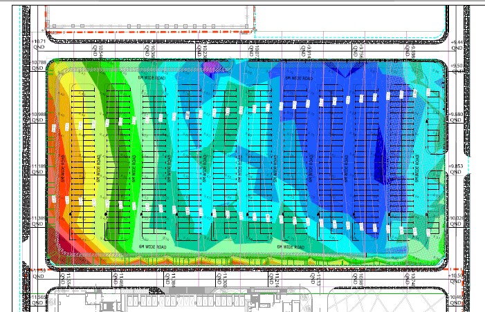
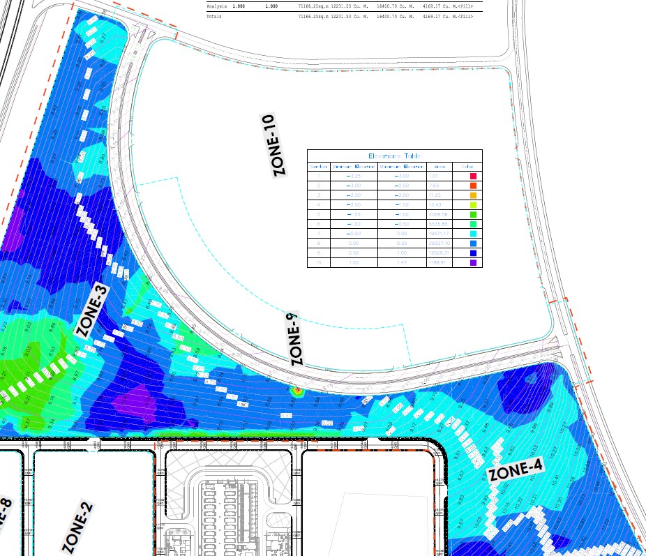
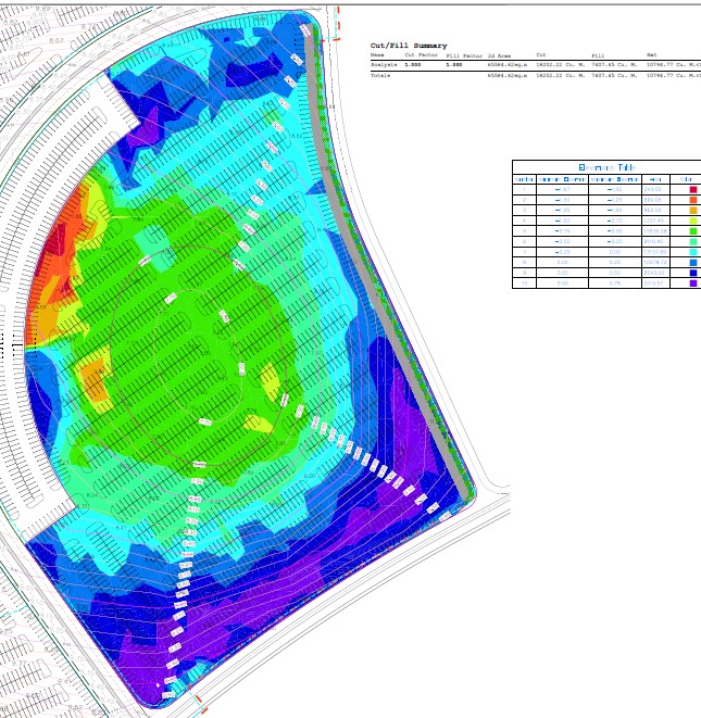
This infrastructure project focused on comprehensive site development using Civil 3D for topography, land fill calculations, and utility modeling. Our team created detailed 3D infrastructure models to support site planning, grading, drainage design, and utility coordination.
Civil Infrastructure Modeling
The project required detailed modeling of site topography, earthworks calculations, and comprehensive utility systems. Our team utilized Civil 3D to create accurate digital terrain models, perform cut and fill analysis, and design complex utility networks including stormwater, sanitary sewer, and water supply systems.
- Detailed digital terrain modeling and grading design
- Cut and fill volume calculations for earthworks
- Stormwater drainage system modeling and analysis
- Underground utility coordination and clash detection
- Integration with architectural and structural models
- Construction sequencing support for site development
Technical Details
Our team used Civil 3D as the primary platform for site development modeling, integrating with Revit and Navisworks for coordination with architectural and structural elements. The project included detailed topographic modeling, earthworks quantity calculations, and comprehensive utility system design at LOD 350, providing sufficient detail for construction while optimizing model performance.