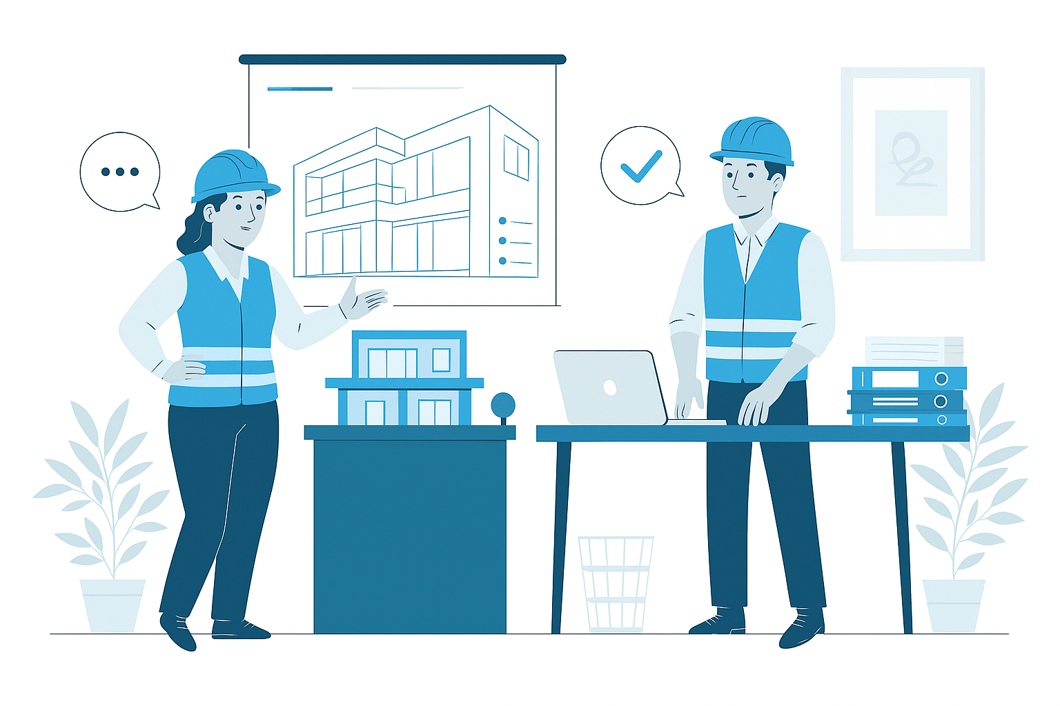
Civil3D Modeling
Civil3D Modeling Services
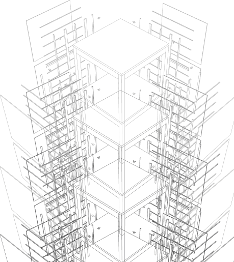
In modern civil engineering and site development, Civil3D has revolutionized how infrastructure projects are designed, analyzed, and documented. Our specialized Civil3D modeling services create intelligent, dynamic 3D representations of site grading, drainage systems, utilities, roadways, and infrastructure components with parametric engineering intelligence. These comprehensive models establish precise spatial relationships, maintain design standards, and preserve engineering integrity throughout design iterations, supporting enhanced analysis, improved coordination, and more effective implementation of complex civil engineering projects.
Site & Infrastructure
- Dynamic 3D modeling of site development, grading, and infrastructure components
- Parametric surface models with precise earthwork and drainage analysis
- Comprehensive corridor modeling for roads, intersections, and transportation elements
- Intelligent utility networks with proper slopes, inverts, and connectivity
- Engineering-grade models supporting analysis, documentation, and construction
Comprehensive Civil Engineering Modeling
Our Civil3D modeling services implement a systematic approach that develops intelligent digital representations of site and infrastructure projects. We begin with comprehensive data acquisition from surveys, property records, and existing conditions to establish accurate base models. From this foundation, we develop dynamic engineering models with parametric intelligence, proper relationships, and design standards that maintain integrity throughout modifications. These models incorporate terrain development, grading design, roadway configurations, utility systems, and stormwater management with appropriate engineering parameters and performance specifications.
Throughout development, our engineering analysis validates design performance including drainage calculations, earthwork quantities, utility capacity, and geometric compliance with applicable standards and regulations. For complex infrastructure projects, integrated validation tools confirm proper slopes, clearances, capacities, and operational parameters that ensure practical functionality and code compliance. The completed Civil3D models provide comprehensive digital representation with appropriate engineering intelligence, dynamic relationships, and detailed components supporting both design optimization and construction implementation. This integrated approach transforms traditional civil documentation into intelligent digital models that substantially improve analysis capabilities, enhance documentation efficiency, and support effective project delivery across site development, transportation, and utility applications.
Strategic Benefits of Civil3D Modeling
Implementing comprehensive Civil3D modeling delivers substantial advantages throughout engineering design, analysis, documentation, and construction implementation. During design development, the parametric intelligence enables rapid iterations, alternative evaluation, and optimization studies that significantly improve engineering outcomes while maintaining compliance with design standards and regulatory requirements. The dynamic nature of Civil3D models ensures that when design changes occur, all related components automatically update with proper engineering behavior, maintaining slopes, alignments, profiles, and quantities without manual recalculation or drawing updates.
For engineering analysis, Civil3D provides integrated tools for drainage studies, earthwork calculations, geometric verification, and performance validation that enhance design quality while ensuring regulatory compliance. During documentation, the model generates coordinated drawing sets with plans, profiles, sections, and details derived directly from the validated engineering environment, ensuring complete consistency between different views without the discrepancies that frequently occur with traditional drafting methods. Throughout construction, these capabilities combine to reduce implementation costs by 10-15%, decrease field conflicts by 30-40%, and significantly improve infrastructure quality compared to conventional approaches. By creating intelligent, accurate digital representations during design, Civil3D modeling delivers substantial improvements in both engineering efficiency and project outcomes, providing significant value throughout the complete project lifecycle from conceptual planning through construction completion.
Applications of Civil3D Modeling
Commercial & Industrial Development
Comprehensive Civil3D modeling for retail centers, office parks, industrial facilities, and commercial properties with complex site requirements. Our commercial site models address grading, drainage, utilities, access, circulation, and stormwater management with appropriate engineering standards and performance requirements. These detailed models support the demanding site development needs, complex stakeholder coordination, and regulatory compliance requirements necessary for successful implementation of these significant development projects.
Residential & Subdivision Development
Detailed Civil3D modeling for residential communities, subdivisions, mixed-use developments, and multi-family projects with comprehensive infrastructure requirements. Our residential development models address lot configuration, street layout, grading design, utility systems, and stormwater management with appropriate standards and construction parameters. These comprehensive models support the complex planning requirements, phasing strategies, and municipal approvals necessary for successful implementation of these large-scale residential communities.
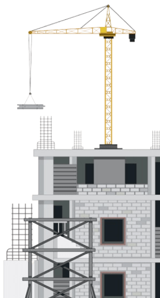
Transportation & Roadway Projects
Specialized Civil3D modeling for highways, local roads, intersections, interchanges, and transportation corridors with precise geometric requirements. Our transportation models address alignment design, vertical profiles, cross-sections, intersection configurations, and drainage systems with appropriate engineering standards and design criteria. These detailed models support the exacting technical requirements, safety provisions, and performance standards necessary for successful implementation of these critical transportation infrastructure projects.
Stormwater & Environmental Projects
Comprehensive Civil3D modeling for stormwater management, flood control, water quality, and environmental improvement projects with complex hydrologic requirements. Our stormwater models address collection systems, conveyance networks, detention facilities, treatment measures, and outfall structures with accurate capacity parameters and performance specifications. These detailed models support both regulatory compliance and construction implementation while ensuring proper system function, environmental protection, and long-term performance for these critical infrastructure improvements.
Why Choose Us
Advanced Civil3D Modeling Services That Enhance Infrastructure Design and Development
01
Expert Team
Certified BIM specialists with extensive experience across architectural, MEP, and facade modeling projects
02
Comprehensive Services
End-to-end BIM solutions from initial modeling to coordination, documentation, and facility management
03
Quality Assurance
Rigorous quality control processes ensuring clash-free models, accurate documentation, and seamless collaboration
04
Dedicated Support
Responsive team available to assist throughout your project lifecycle, ensuring timely solutions and continuous assistance


Know More
Frequently Asked Questions
Civil3D Modeling is the specialized process of creating intelligent, dynamic 3D digital representations of site development, grading, drainage, utilities, and infrastructure components using Autodesk Civil 3D software. Unlike traditional CAD drafting or basic 3D modeling, Civil3D creates parametric models with dynamic relationships between components, maintaining engineering intelligence and design integrity throughout modifications. This approach has become critical for successful infrastructure projects because it enables precise coordination between grading, utilities, and structures while maintaining compliance with engineering standards and design parameters. The dynamic nature of Civil3D models allows rapid design iterations, automated quantity calculations, and comprehensive analysis capabilities that substantially improve both design quality and project efficiency. Industry experience shows that projects implementing comprehensive Civil3D modeling typically experience 25-35% reduced design development time, 30-40% fewer coordination issues, and significant improvements in both construction documentation quality and field implementation outcomes. Beyond basic documentation benefits, Civil3D modeling supports critical functions including earthwork optimization, drainage analysis, utility conflict detection, and regulatory compliance verification that collectively enhance both the design process and constructed outcomes for complex site and infrastructure projects throughout the complete project lifecycle.
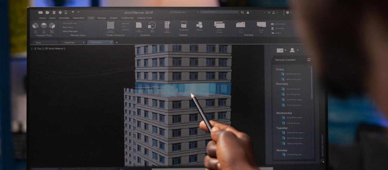
Our Civil3D modeling process follows a structured methodology that systematically develops comprehensive digital representations of site and infrastructure projects. We begin with data acquisition, gathering existing information including surveys, property boundaries, geotechnical reports, utility records, and environmental data to establish accurate base conditions. Initial planning establishes model organization, design parameters, and engineering standards based on project requirements and regulatory constraints. The modeling development proceeds through progressive phases starting with existing condition representation and property configuration before addressing grading design, stormwater management, utility systems, roadway development, and specialized infrastructure components. For grading development, we create intelligent surface models with proper slopes, drainage patterns, and earthwork optimization that balance cut and fill while meeting design requirements. Roadway and transportation elements are developed through corridor modeling with accurate alignments, profiles, and cross-sections that define complete three-dimensional geometrics. Utility infrastructure is modeled with pipe networks, structures, and service components featuring proper slopes, inverts, and connection relationships. Throughout development, our engineering analysis validates design performance including drainage calculations, earthwork quantities, utility capacity, and geometric verification against applicable standards. Quality control processes confirm dimensional accuracy, engineering compliance, and design integrity throughout the model. The completed Civil3D model incorporates appropriate annotations, labels, and technical parameters supporting both engineering validation and construction implementation. This comprehensive approach ensures all site and infrastructure elements receive appropriate development regardless of project complexity while maintaining engineering intelligence and design relationships throughout the complete digital environment.
Our Civil3D modeling services address diverse project types across site development, transportation, and infrastructure applications with appropriate modeling approaches and engineering parameters. For site development, we model commercial properties, industrial facilities, institutional campuses, and residential developments with complete grading, access, utilities, and stormwater management. Transportation projects include roadway systems, intersections, interchanges, and alignment improvements with accurate geometric design, profile development, and cross-section articulation. Subdivision development encompasses residential communities, mixed-use developments, and planned unit developments with property configuration, street layouts, utility infrastructure, and stormwater systems. Water resources projects address drainage systems, stormwater management, flood control, water quality, and treatment facilities with accurate hydraulic modeling and performance analysis. Utility infrastructure includes water distribution, sanitary sewer collection, stormwater conveyance, and service connections with proper network development and system relationships. Land development projects incorporate property boundaries, easements, rights-of-way, and legal descriptions with accurate survey information and parcel geometry. Linear infrastructure modeling addresses pipelines, corridors, transmission lines, and distribution networks with proper alignment control and component placement. Municipal projects include public infrastructure, parks, recreational facilities, and community improvements with appropriate engineering standards and regulatory compliance. Each project type receives tailored modeling approaches based on specific requirements, complexity, and implementation needs, creating information-rich digital representations that support both design development and construction implementation regardless of scale or application.
Civil3D modeling delivers substantial design advantages and construction improvements through dynamic engineering intelligence and integrated 3D representation. The primary design benefit comes through parametric relationships, where intelligent components maintain proper engineering behavior when design changes occur, automatically updating elevations, slopes, alignments, and quantities while preserving design intent. This dynamic capability enables rapid design iterations, alternative analysis, and optimization studies that significantly improve engineering outcomes while reducing design development time by 25-35% compared to traditional methods. For construction documentation, Civil3D generates consistent drawing sets directly from the validated model, ensuring plans, profiles, sections, and details accurately reflect the same design information without discrepancies that frequently occur with manual drafting methods. During construction planning, the comprehensive model supports precise quantity takeoffs, accurate material estimation, and detailed earthwork analysis that collectively improve project bidding and resource allocation. These capabilities typically reduce quantity discrepancies by 40-60%, decrease construction uncertainties, and significantly improve bid accuracy compared to traditional documentation methods. Throughout implementation, clear 3D visualization, accurate stake-out data, and comprehensive grading information enhance field understanding and construction efficiency. By creating intelligent, accurate digital representations during design, Civil3D modeling delivers substantial improvements in both engineering quality and construction outcomes, reducing overall project costs, accelerating delivery timelines, and enhancing infrastructure performance throughout its operational lifetime.
Our Civil3D models provide tailored detail levels calibrated to project requirements, engineering needs, and construction methodology across different infrastructure applications. For terrain and existing conditions, models include accurate topographic representation, property boundaries, existing infrastructure, and environmental features with appropriate survey accuracy and elevation control. Grading models incorporate detailed surface development with proper slopes, transitions, spot elevations, and drainage patterns that define complete three-dimensional landforms with engineering precision. Transportation elements including roadways, intersections, and access features receive comprehensive corridor modeling with detailed alignments, profiles, assemblies, and design controls that define complete geometric configurations. Stormwater management components include collection structures, conveyance systems, detention facilities, and treatment measures with proper sizing, elevation control, and performance parameters. Underground utilities receive accurate horizontal positioning, proper vertical profiles, structure details, and connection relationships with appropriate pipe sizing and slope characteristics. Site improvements including pavements, curbs, sidewalks, and hardscape elements incorporate proper dimensions, materials, and construction details with appropriate transition conditions and accessibility compliance. The appropriate detail level for each project element is determined through systematic analysis of engineering requirements, regulatory standards, and construction methodology, ensuring models provide necessary information without excessive detail when not required. Throughout all development, models maintain parametric intelligence, design relationships, and engineering parameters that support comprehensive project validation beyond simple geometric representation, creating dynamic digital environments that enhance both design optimization and construction implementation throughout the project lifecycle.
Our Civil3D implementation provides substantial support for engineering analysis and design validation through integrated calculation tools and simulation capabilities. For grading and earthwork analysis, the dynamic surface modeling enables precise cut/fill calculations, balance evaluations, and optimization studies that improve site development efficiency and reduce material movement costs. These capabilities typically improve earthwork balance by 15-25% while providing accurate volume verification throughout design development. Stormwater management benefits from comprehensive drainage analysis including watershed delineation, runoff calculation, pipe sizing, detention modeling, and water quality evaluation with appropriate regulatory standards and performance requirements. Transportation design validation includes sight distance analysis, vertical clearance verification, superelevation calculation, and turning movement studies that ensure compliance with applicable design standards and safety requirements. For utility systems, Civil3D supports capacity analysis, flow studies, pressure evaluations, and conflict detection with accurate component representation and network connectivity. Throughout design development, these analysis capabilities enable data-driven optimization including alternative evaluation, performance comparison, and cost analysis that improve engineering outcomes. The dynamic modeling environment enables rapid design iterations, provides immediate feedback on engineering changes, and maintains calculation integrity through integrated data management. By combining detailed spatial modeling with engineering analysis tools, Civil3D transforms traditional design processes into integrated digital workflows that substantially improve both design quality and engineering efficiency while ensuring regulatory compliance and performance validation throughout project development.
Our Civil3D models provide comprehensive support for construction documentation and field implementation through consistent drawing production and detailed construction information. For documentation development, the integrated model generates coordinated drawing sets with plans, profiles, sections, and details derived directly from the validated 3D environment, ensuring complete consistency between different drawing types and views. This approach typically reduces documentation time by 30-40% while significantly improving drawing accuracy and coordination compared to traditional methods. Construction documentation includes precise grading plans with spot elevations, contours, and slope indications; detailed utility plans with accurate horizontal and vertical information; comprehensive roadway documentation with station references and geometric data; and detailed construction details with proper dimensions and specifications. For quantity management, Civil3D enables accurate material calculations, detailed earthwork volumes, and comprehensive component counts that support precise cost estimation, material procurement, and resource planning. During field implementation, models provide construction stake-out data, machine control information, and digital terrain models that support modern construction technology including GPS-guided equipment and field positioning systems. Throughout construction, the comprehensive digital representation supports field questions, design modifications, and implementation verification through consistent reference information and clear visualization. These capabilities combine to reduce construction RFIs by 40-60%, improve field understanding, and enhance overall installation quality by providing complete, accurate construction information derived directly from the validated engineering model. This integrated approach transforms civil design documentation from disconnected drawing production into cohesive information delivery that significantly improves both documentation efficiency and construction outcomes throughout project implementation.
Our Civil3D modeling services provide comprehensive deliverables tailored to project requirements and implementation needs. The primary deliverable is the intelligent Civil3D model containing dynamic objects, parametric relationships, and engineering intelligence that supports ongoing design development, analysis capabilities, and future modifications. This model is accompanied by complete construction documentation including site plans with existing and proposed conditions; grading plans with contours, spot elevations, and slope indicators; utility plans with horizontal and vertical information; roadway documentation with alignments, profiles, and cross-sections; stormwater management plans with drainage patterns and control measures; and detailed construction details with proper dimensions and specifications. For engineering validation, we provide analysis reports including earthwork calculations, drainage studies, utility verification, and geometric validation with appropriate regulatory references and performance standards. Construction support deliverables include quantity takeoffs with detailed material volumes, component counts, and area calculations; digital terrain models for machine control and construction technology; stake-out data with coordinate information and positioning references; and 3D visualization products that enhance field understanding and implementation planning. When required, we provide specialized deliverables including rendering visualization, presentation materials, public engagement documentation, and regulatory submission packages with appropriate formatting and content organization. All deliverables maintain consistent information derived directly from the validated Civil3D model, ensuring complete coordination between different document types and information formats. This comprehensive approach provides complete project documentation that supports both regulatory approval and efficient construction implementation, delivering substantial value throughout the complete project lifecycle from concept development through final construction completion.
Wide Range of SERVICES
Other Infrastructure Services
Explore our comprehensive infrastructure modeling services that support planning, design, and construction of complex civil and site development projects.
Apply BIM methodologies to infrastructure projects including roads, bridges, utilities, and site development for improved coordination and delivery.

Develop detailed 3D models of landscape elements including terrain, vegetation, hardscape, and site amenities for visualization and coordination.

Model underground utilities and infrastructure including water, sewer, drainage, power, and communication systems for better coordination.