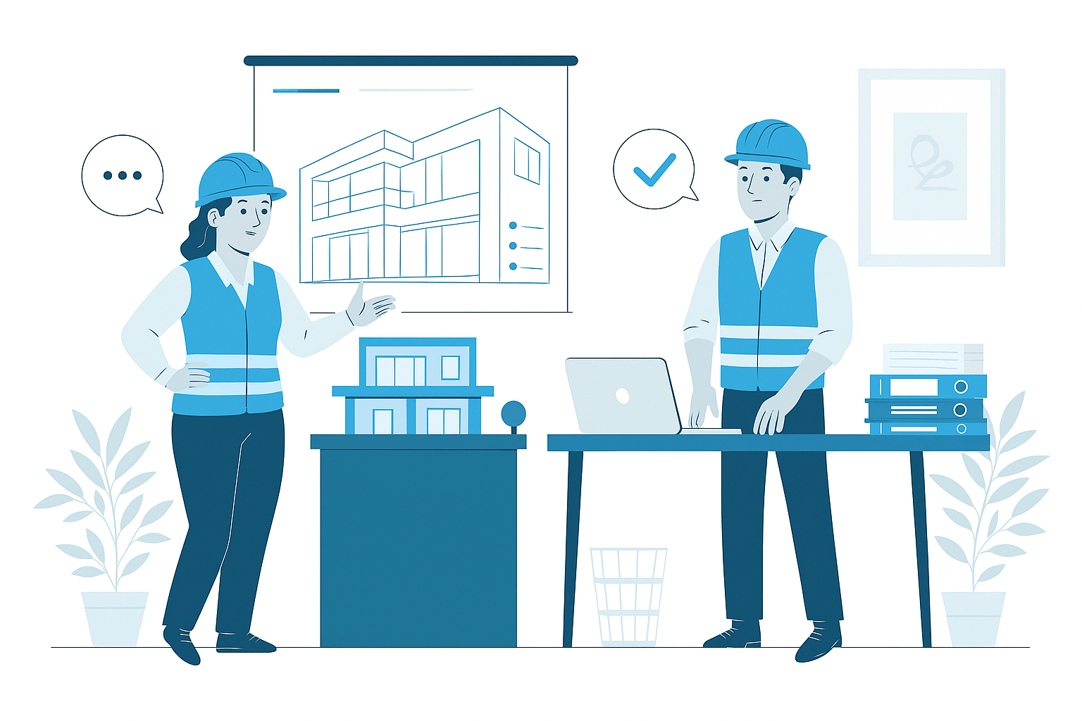
Landscape Modeling
Landscape Modeling Services
In contemporary site design and development, detailed landscape modeling has become essential for creating cohesive, functional, and environmentally responsive exterior environments. Our specialized landscape modeling services create comprehensive 3D representations of complete site contexts including terrain, vegetation, hardscape elements, and site amenities that surround and integrate with building projects. These detailed models establish spatial relationships, material characteristics, and environmental features that support enhanced visualization, improved coordination, and more effective implementation of exterior spaces throughout the project lifecycle.
- Detailed 3D modeling of complete exterior environments and site contexts
- Comprehensive representation of terrain, vegetation, hardscape, and site amenities
- Accurate topographic modeling with proper grading and drainage patterns
- Integration of planting designs with appropriate species characteristics
- Coordination between landscape elements, buildings, and infrastructure systems
Comprehensive Landscape Environment Modeling
Our landscape modeling services implement a systematic approach that develops detailed digital representations of complete exterior environments. We begin with comprehensive site analysis to establish existing conditions, environmental factors, and contextual relationships that inform landscape development. Based on design intent and project requirements, we create accurate terrain models with proper topography, grading modifications, and drainage patterns that establish the fundamental structure of the exterior environment. These base conditions are enhanced with detailed circulation systems including pathways, plazas, and access features that define primary landscape organization and movement patterns.
The landscape composition is developed through comprehensive modeling of vegetation zones, planting areas, and individual plant materials with appropriate species characteristics and growth habits. Hardscape elements including walls, pavements, structures, and site furnishings are modeled with accurate dimensions, material properties, and construction details. Specialized components including water features, lighting systems, and site amenities receive detailed development with proper spatial relationships and technical parameters. Throughout this process, our coordination protocols ensure proper integration between landscape elements, building components, and infrastructure systems while validating design responses to environmental factors including solar orientation, views, and microclimates. The completed landscape models provide comprehensive digital representations of exterior environments with appropriate detail levels, material characteristics, and technical parameters supporting both visualization and construction implementation across diverse project applications.
Strategic Benefits of Landscape Modeling
Implementing comprehensive landscape modeling delivers substantial advantages throughout site design, visualization, coordination, and construction implementation. During design development, the detailed 3D environment enables enhanced spatial understanding, improved material relationships, and optimized environmental responses through comprehensive digital prototyping before physical implementation. The visual clarity provides powerful client communication, stakeholder engagement, and design validation that collectively build project support and establish appropriate expectations for the completed landscape.
For integration and coordination, landscape modeling identifies spatial conflicts between site elements, underground utilities, and building components before construction begins. This proactive coordination prevents costly field conflicts that typically require replanting, hardscape modifications, or drainage corrections when discovered during implementation. During construction planning, detailed landscape models support precise material quantification, accurate planting layouts, and optimized installation sequencing that collectively improve project logistics and resource allocation. Throughout project delivery, these benefits combine to reduce landscape installation costs by 10-15%, decrease implementation timelines by 15-20%, and significantly enhance the quality and alignment with design intent for the completed exterior environment. Beyond construction completion, the comprehensive digital representation provides valuable reference information for landscape management, maintenance operations, and future modifications that extends these benefits throughout the entire site lifecycle.
Applications of Landscape Modeling
Commercial & Mixed-Use Development
Comprehensive landscape modeling for office campuses, retail centers, corporate headquarters, and mixed-use developments with sophisticated exterior environments. Our commercial landscape models address plazas, entry sequences, amenity spaces, and circulation networks with appropriate material quality and spatial organization. These detailed models support the identity objectives, pedestrian accessibility, and user experience requirements while ensuring proper integration with architecture, parking systems, and infrastructure throughout these complex development projects.
Healthcare & Healing Environments
Specialized landscape modeling for hospitals, medical centers, rehabilitation facilities, and wellness environments with therapeutic outdoor spaces. Our healthcare landscape models address healing gardens, meditation spaces, accessible pathways, and sensory environments with appropriate plant selection and user accommodation. These detailed models support the special requirements of healthcare landscapes including safety provisions, maintenance considerations, and therapeutic benefits while ensuring proper integration with medical facilities and operational requirements.
Campus & Educational Environments
Detailed landscape modeling for university grounds, educational campuses, school sites, and institutional facilities with diverse outdoor program requirements. Our campus landscape models address gathering spaces, circulation networks, recreational areas, and learning environments with appropriate spatial organization and user functionality. These comprehensive models support both aesthetic quality and operational requirements while ensuring proper integration with academic buildings, student activities, and infrastructure systems throughout these complex educational environments.
Parks & Public Spaces
Comprehensive landscape modeling for urban parks, public plazas, recreational facilities, and community spaces with diverse user requirements and high-performance expectations. Our public space models address lawn areas, planting designs, hardscape elements, activity zones, and site amenities with appropriate durability and maintenance considerations. These detailed models support the public engagement processes, regulatory requirements, and operational considerations necessary for successful implementation of these important civic spaces that enhance community identity and quality of life.
Why Choose Us
Advanced Landscape Modeling Services That Enhance Site Design and Visualization
01
Expert Team
Certified BIM specialists with extensive experience across architectural, MEP, and facade modeling projects
02
Comprehensive Services
End-to-end BIM solutions from initial modeling to coordination, documentation, and facility management
03
Quality Assurance
Rigorous quality control processes ensuring clash-free models, accurate documentation, and seamless collaboration
04
Dedicated Support
Responsive team available to assist throughout your project lifecycle, ensuring timely solutions and continuous assistance


Know More
Frequently Asked Questions
Landscape Modeling is the specialized process of creating detailed 3D digital representations of exterior environments including terrain, vegetation, hardscape elements, site amenities, and outdoor spaces that form the complete site context for building projects. Unlike traditional 2D landscape documentation that merely shows approximate layouts, landscape modeling creates comprehensive digital environments with accurate spatial relationships, material properties, contextual integration, and environmental characteristics. This approach has become increasingly important as projects demand better site integration, enhanced outdoor functionality, improved environmental performance, and more compelling visual expression of exterior spaces. Effective landscape modeling enables early design validation, improved coordination with buildings and infrastructure, enhanced client communication, and better construction planning that collectively improves project outcomes. Industry experience shows that projects implementing comprehensive landscape modeling typically experience 20-30% better alignment between design intent and constructed outcomes, 25-35% fewer site-related construction conflicts, and significant improvements in both stakeholder satisfaction and long-term site performance. Beyond practical coordination benefits, landscape modeling supports critical functions including environmental analysis, sustainable design strategies, construction logistics planning, and long-term site management that collectively enhance both the implementation and ongoing performance of the complete exterior environment throughout the project lifecycle.
Our landscape modeling process follows a structured methodology that systematically develops comprehensive digital representations of exterior environments. We begin with site analysis and data acquisition, collecting information from surveys, geotechnical reports, environmental studies, and existing condition documentation to establish accurate base conditions for model development. Initial planning establishes design parameters, spatial organization, functional requirements, and aesthetic goals based on project vision and program needs. The modeling development proceeds through progressive phases starting with terrain development and context integration before addressing circulation systems, vegetation zones, hardscape elements, water features, site amenities, and lighting components. For terrain modeling, we develop accurate topographic representation with proper grading, drainage patterns, and earth forms that establish the fundamental structure of the landscape environment. Circulation systems including pathways, plazas, stairs, and access features receive detailed modeling with proper materials, dimensions, and accessibility compliance. Vegetation modeling incorporates trees, shrubs, groundcover, and planting areas with appropriate species representation, growth characteristics, and seasonal variations. Hardscape elements including walls, paving, structures, and site furnishings are modeled with accurate dimensions, material properties, and construction details. Throughout development, our integration processes ensure proper coordination with buildings, infrastructure systems, and existing site elements. Environmental factors including solar orientation, prevailing winds, views, and microclimates are analyzed to validate design responses and performance characteristics. The completed landscape models incorporate appropriate material properties, planting information, and technical parameters supporting both visualization and construction implementation. This comprehensive approach ensures all landscape elements receive appropriate development while maintaining consistent quality and design integrity throughout the exterior environment.
Our landscape modeling services address comprehensive exterior environments with detailed component representation across all site elements. For terrain features, we model topographic conditions, grading modifications, slope treatments, retaining structures, and landforms with accurate elevation control and drainage characteristics. Circulation systems include vehicular roadways, parking areas, pedestrian pathways, plazas, terraces, stairs, ramps, and specialized paving with proper dimensions, materials, and accessibility compliance. Vegetation elements incorporate large specimen trees, ornamental trees, evergreen screens, shrub masses, perennial gardens, groundcover areas, turf zones, and specialized plantings with appropriate species characteristics, growth habits, and seasonal appearances. Hardscape features include site walls, raised planters, seating elements, decorative structures, pergolas, and architectural accents with detailed dimensions and material properties. Water elements encompass fountains, reflecting pools, water courses, ponds, and stormwater features with appropriate edge conditions, mechanical components, and operational characteristics. Site amenities include outdoor furniture, play equipment, fitness stations, signage elements, lighting fixtures, and specialized recreational features with accurate dimensions and placement criteria. Utility integration addresses site lighting, irrigation systems, drainage infrastructure, power distribution, and outdoor technology with proper component representation and service connections. Specialized environments including rooftop gardens, healing landscapes, educational spaces, and public plazas receive detailed treatment with appropriate program elements and operational features. Each landscape component receives appropriate modeling development based on project requirements, design intent, and construction methodology, creating comprehensive digital representations supporting visualization, coordination, and implementation throughout the project lifecycle.
Landscape modeling delivers substantial coordination benefits and construction improvements through comprehensive digital integration and enhanced site understanding. The primary coordination advantage comes through accurate spatial definition, where 3D modeling establishes clear relationships between landscape elements, building components, and underground infrastructure before construction begins. This integration prevents costly conflicts between plantings and utilities, hardscape and drainage systems, or site walls and building foundations that frequently occur with traditional documentation methods. For complex grade transitions, retaining structures, and accessibility routes, the detailed 3D representation enables precise elevation control, improved transitional elements, and enhanced compliance verification that significantly reduces field issues during implementation. Beyond physical coordination, landscape modeling supports critical construction planning including site access strategies, material staging areas, equipment routing, and protection zones that improve project logistics while minimizing disruption to existing environments. During implementation, the comprehensive model enables precise material quantification, accurate planting layouts, and detailed construction sequencing that collectively improve installation efficiency. These coordination capabilities typically reduce landscape RFIs by 30-50%, decrease site-related change orders by 25-40%, and significantly improve installation quality compared to traditional documentation methods. By resolving integration challenges during the digital design phase rather than during physical construction, landscape modeling delivers substantial cost savings, schedule improvements, and quality enhancements throughout the exterior environment implementation process.
Our landscape models provide tailored detail levels calibrated to project requirements, visualization needs, and implementation methodology across different exterior elements. For terrain and grading, models include accurate topographic representation, earthwork modifications, slope transitions, and drainage patterns with appropriate survey accuracy and elevation control. Primary landscape structures including walls, stairs, ramps, and specialized elements receive comprehensive component modeling with accurate dimensions, material definition, connection details, and construction properties. Hardscape areas including plazas, pathways, and paved surfaces incorporate detailed paving patterns, material transitions, edge conditions, and drainage features with proper dimensional control and material specification. Planting areas receive appropriate zoning, soil depth indication, mulch areas, and edging details with clear boundaries and preparation requirements. Individual plant materials are represented according to project phase and visualization needs, ranging from symbolic species representation during initial design to detailed growth stage modeling for presentation visualization. Site amenities including furniture, fixtures, equipment, and specialized elements are modeled with dimensional accuracy and proper placement relationships. Water features include basin configuration, edge details, mechanical requirements, and operational characteristics with appropriate construction parameters. The appropriate detail level for each landscape element is determined through systematic analysis of design requirements, visualization objectives, and construction methodology, ensuring models provide necessary information without excessive detail when not required. Throughout all development, models maintain component relationships, material properties, and technical parameters that support comprehensive project understanding beyond simple geometric representation, creating information-rich digital environments that enhance both visual communication and construction implementation.
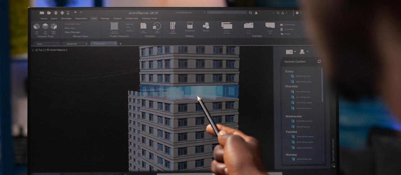
Our landscape modeling services implement specialized software platforms and technologies optimized for exterior environment representation and site development. For comprehensive landscape development, we utilize Autodesk Civil 3D for accurate terrain modeling, grading development, and site engineering with proper topographic representation and drainage analysis. This environment is supplemented by specialized landscape extensions, plant libraries, and site development tools tailored to exterior environment modeling. For detailed landscape component development and architectural integration, we implement Autodesk Revit with specialized site tools, custom families, and landscape components that properly represent exterior elements within the building context. Specialized visualization platforms include Lumion, Twinmotion, and 3D Studio Max with enhanced vegetation libraries, material systems, and environmental controls that create compelling landscape visualizations with proper seasonal characteristics and lighting conditions. For advanced planting design and vegetation management, we utilize specialized horticultural software including Land F/X, VectorWorks Landmark, and custom plant databases that support species selection, growth modeling, and maintenance planning. These primary platforms are enhanced by specialized applications including SketchUp for conceptual modeling, Rhino for complex landform development, and Adobe Creative Suite for enhanced visualization processing. For coordination and site integration, we utilize Navisworks, BIM 360, and specialized clash detection tools with appropriate rule sets optimized for landscape applications. Environmental analysis applications support design validation including solar studies, microclimate simulation, stormwater modeling, and irrigation analysis that integrate with modeling workflows to verify landscape performance. These technology platforms are continuously updated to incorporate emerging capabilities including photorealistic rendering, seasonal variation simulation, and growth modeling applications that enhance both development quality and visualization capabilities throughout the landscape design and implementation process.
Our landscape modeling approach provides substantial support for sustainable site design and environmental analysis through detailed digital environments and integrated performance evaluation. For stormwater management, comprehensive terrain and surface modeling enables precise runoff analysis, flow pattern evaluation, retention capacity calculation, and infiltration performance that validate sustainable water management strategies. Vegetation planning benefits from species-specific modeling that supports canopy coverage calculation, carbon sequestration estimation, habitat value assessment, and biodiversity evaluation with appropriate growth projections and maintenance considerations. Microclimate analysis utilizes 3D landscape modeling to evaluate solar exposure, shade patterns, wind effects, and thermal performance that influence human comfort, energy consumption, and plant viability throughout exterior environments. Material selection processes integrate with modeling through pervious surface calculation, heat island mitigation assessment, and embodied carbon evaluation that support sustainable material strategies and performance objectives. For integrated site systems, comprehensive modeling enables rainwater harvesting analysis, graywater reuse planning, renewable energy integration, and habitat creation that enhance overall site sustainability. Throughout design development, these analysis capabilities support performance verification, requirement compliance, and certification documentation for programs including LEED, SITES, and Living Building Challenge. The comprehensive digital approach enables rapid evaluation of design alternatives, provides immediate feedback on performance impacts, and maintains sustainability data through integrated information management. By combining detailed spatial modeling with environmental analysis, landscape modeling transforms traditional design processes into performance-based workflows that substantially improve both environmental outcomes and sustainability achievements throughout project development and implementation.
Our landscape models provide powerful visualization capabilities that significantly enhance client communication, stakeholder engagement, and design understanding throughout project development. The foundation for these benefits is comprehensive 3D representation, where models create accurate spatial experiences, material relationships, and environmental contexts that communicate landscape design intent more effectively than traditional 2D documentation. For client presentations, models enable dynamic walkthroughs, perspective views, and immersive experiences that convey spatial qualities, material characteristics, and environmental relationships with compelling visual clarity. Seasonal variation analysis utilizes landscape modeling to demonstrate planting appearances, shadow patterns, and environmental conditions across different times of year, validating design decisions and setting appropriate expectations for landscape maturation. For public engagement, models support presentation renderings, animated sequences, and interactive applications that effectively communicate design concepts to diverse stakeholders with varying technical backgrounds. Visualization capabilities address both daytime appearances and nighttime conditions, demonstrating lighting effects, fixture performance, and evening experiences that validate complete 24-hour landscape functionality. Throughout design development, rapid visualization updates enable real-time design exploration, alternative evaluation, and iterative refinement that significantly improve client participation and decision-making processes. These communication capabilities typically reduce design revisions by 30-40%, improve stakeholder consensus by 40-50%, and significantly enhance client satisfaction compared to traditional presentation methods. By creating compelling visual experiences before physical implementation, landscape modeling establishes clear design understanding, builds project support, and creates appropriate expectations that collectively improve both client relationships and project outcomes throughout landscape development.
Wide Range of SERVICES
Other Infrastructure Services
Explore our comprehensive infrastructure modeling services that support planning, design, and construction of complex civil and site development projects.
Apply BIM methodologies to infrastructure projects including roads, bridges, utilities, and site development for improved coordination and delivery.

Create detailed Civil3D models for site development, grading, drainage, utilities, and infrastructure components with precision and accuracy.

Model underground utilities and infrastructure including water, sewer, drainage, power, and communication systems for better coordination.