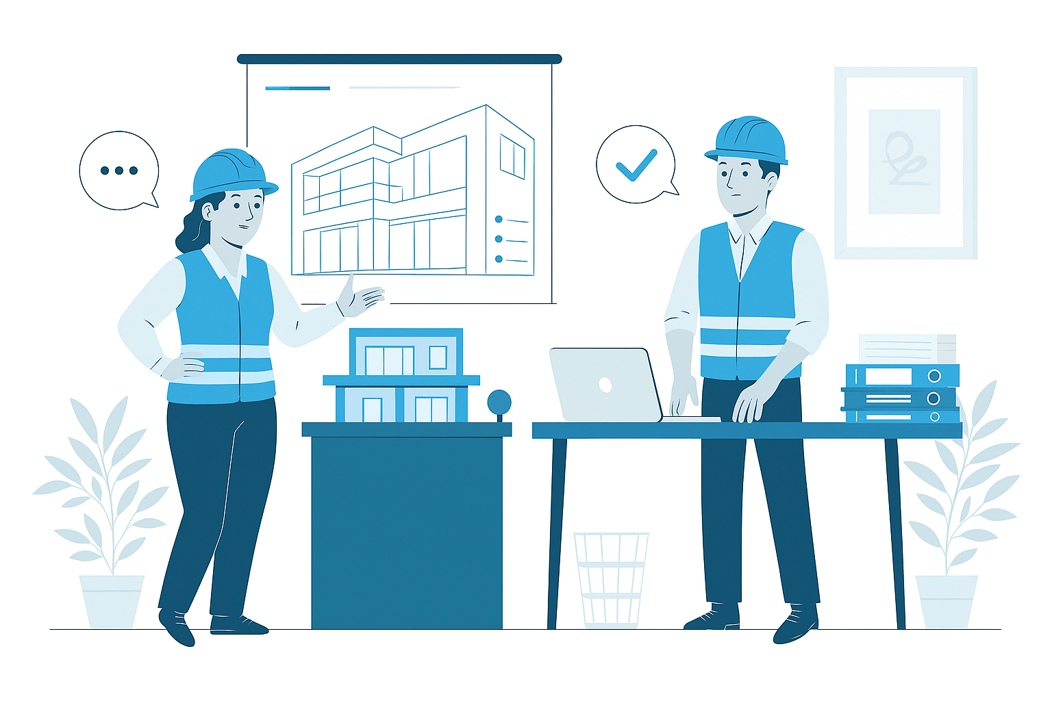
LiDAR Scanning
LiDAR Scanning Services
In today's documentation landscape, LiDAR Scanning represents the most advanced approach to capturing existing building and site conditions with exceptional accuracy and completeness. Our specialized scanning services employ laser-based measurement technology to create comprehensive point cloud datasets that precisely document all visible surfaces and spatial relationships. These high-fidelity digital captures provide millimeter-accurate representations of existing conditions, creating an invaluable foundation for renovation planning, as-built documentation, BIM modeling, and facility management applications.
- High-precision 3D laser scanning with millimeter-level accuracy
- Comprehensive point cloud datasets documenting all visible surfaces
- Complete spatial capture of interior and exterior building conditions
- Registered and geo-referenced point cloud deliverables
- Integration-ready data for BIM modeling and design applications
Comprehensive Reality Capture Solutions
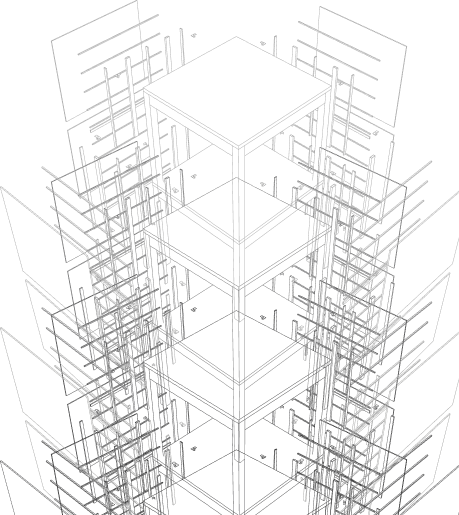
Our LiDAR Scanning services deliver exceptionally detailed documentation of existing conditions through advanced laser measurement technology. Using sophisticated scanning equipment, we capture millions of precisely measured points that collectively create a comprehensive digital representation of physical spaces. These high-density point clouds document exact dimensions, spatial relationships, surface characteristics, and material conditions with millimeter-level accuracy, providing an objective record of existing conditions far more complete than traditional documentation methods. The resulting datasets serve as definitive digital references for all visible building elements and site features.
We provide scanning solutions tailored to diverse project requirements and environments—from individual rooms and specific building components to entire facilities and complex sites. Our services address interior documentation needs including architectural features, structural elements, and mechanical systems with appropriate detail levels and accuracy specifications. For exterior applications, we capture building facades, site conditions, topographic features, and contextual elements with comprehensive coverage and georeferenced positioning. This versatile approach ensures optimal documentation regardless of project scale or complexity, delivering precisely the spatial data needed to support successful project outcomes in renovation, documentation, and facility management applications.
Strategic Benefits of LiDAR Scanning
LiDAR Scanning delivers transformative advantages for projects involving existing buildings and sites through unprecedented documentation quality. The exceptional accuracy and completeness of scanning data significantly reduces uncertainty in renovation planning, allowing designers to create solutions with confidence that they will properly integrate with existing conditions. This improved information foundation prevents costly surprises during construction, reduces change orders, and minimizes field adjustments that can impact budgets and schedules. Throughout design development, the comprehensive spatial context provided by scanning enables more informed decisions, better system coordination, and optimized design solutions.
Beyond direct project applications, LiDAR Scanning creates enduring value through digital documentation that serves multiple purposes throughout the building lifecycle. The comprehensive point cloud dataset becomes a permanent digital record of conditions at a specific point in time, supporting future modifications, system planning, and facility management activities. For historic structures, scanning provides invaluable documentation of architectural features, construction methods, and spatial configurations that inform preservation approaches and create permanent records of cultural heritage. This multi-purpose nature of scanning data extends its value far beyond initial project needs, creating a digital asset that continues to deliver benefits throughout facility ownership and management.
Industry Applications of LiDAR Scanning
Renovation & Adaptive Reuse
Specialized scanning services for building renovation, repurposing, and adaptive reuse projects requiring accurate existing condition documentation. Our renovation scanning provides comprehensive spatial data that reveals hidden challenges, identifies structural constraints, and captures dimensional realities. This detailed foundation supports design solutions that properly address existing conditions, optimize space utilization, and minimize construction conflicts while preserving valuable building elements.
Heritage & Historic Preservation
Specialized documentation services for historic buildings, heritage sites, and culturally significant structures requiring precise recording of architectural features and construction details. Our heritage scanning captures intricate ornamental elements, documents traditional construction methods, and preserves comprehensive records of historic fabric. These detailed datasets support authentic restoration approaches, preservation planning, and archival documentation of irreplaceable cultural assets.
Facility Management & Documentation
Comprehensive scanning services for facility management, building operations, and asset documentation applications. Our facility scanning creates accurate spatial inventories, documents equipment locations, and captures system configurations that support space planning, maintenance activities, and retrofit projects. These spatial datasets integrate with facility management systems, provide verification of as-built conditions, and create baseline documentation for ongoing building operations.
Complex Retrofit & MEP Upgrades
Specialized scanning for system upgrade projects, technical retrofits, and complex installations in existing facilities. Our technical scanning documents congested mechanical spaces, captures existing routing pathways, and identifies available clearances to support system upgrades, equipment replacement, and infrastructure improvements. This detailed spatial information reduces installation conflicts, supports prefabrication strategies, and enables precision planning for system interventions in constrained environments.
Why Choose Us
Advanced Reality Capture That Provides Certainty for Existing Conditions
01
Expert Team
Certified BIM specialists with extensive experience across architectural, MEP, and facade modeling projects
02
Comprehensive Services
End-to-end BIM solutions from initial modeling to coordination, documentation, and facility management
03
Quality Assurance
Rigorous quality control processes ensuring clash-free models, accurate documentation, and seamless collaboration
04
Dedicated Support
Responsive team available to assist throughout your project lifecycle, ensuring timely solutions and continuous assistance


Know More
Frequently Asked Questions
LiDAR (Light Detection and Ranging) Scanning is an advanced reality capture technology that uses laser measurement to create highly accurate 3D representations of existing buildings and sites. The technology works by emitting laser pulses that bounce off physical surfaces and return to the scanner, with precise measurement of the time taken determining exact distances. Modern LiDAR scanners collect millions of measurement points within minutes, creating dense 'point clouds' that precisely document all visible surfaces with millimeter-level accuracy. These comprehensive datasets capture complete geometric information including dimensions, spatial relationships, surface variations, and material distinctions that represent the as-built condition of facilities. The non-contact, non-destructive nature of LiDAR makes it ideal for documenting existing buildings efficiently while providing exceptional dimensional accuracy and completeness compared to traditional measurement methods.
LiDAR Scanning delivers substantial benefits across diverse project applications. For renovation and adaptive reuse projects, scanning provides comprehensive documentation of existing conditions that informs design decisions, reveals hidden challenges, and ensures design compatibility with physical realities. Historic preservation efforts benefit from detailed documentation of architectural features, complex geometries, and precise dimensions that support authentic restoration approaches. Facility management applications include comprehensive spatial inventory, equipment documentation, and system mapping that enhances maintenance planning and space utilization. For as-built documentation, scanning creates accurate records of construction outcomes that validate contractor compliance and support lifecycle management. MEP retrofits rely on precise scanning to document congested mechanical spaces, identify system routing pathways, and verify clearances for new equipment. Additional applications include construction verification, prefabrication support, structural analysis, deformation monitoring, and complex site documentation where precise spatial data drives successful project outcomes.
Modern LiDAR Scanning systems deliver exceptional accuracy typically ranging from ±2mm to ±6mm depending on equipment specifications, scanning parameters, and environmental conditions. Our standard scanning protocols achieve registration accuracy (alignment between multiple scans) of ±3mm or better, ensuring consistent precision throughout the documented space. Factors influencing accuracy include scanner technology (phase-based vs. time-of-flight), distance to measured surfaces, surface properties (reflectivity, texture, color), scan resolution settings, and environmental conditions including lighting, dust, and vibration. To ensure optimal accuracy, we implement rigorous scanning methodologies including proper scan station positioning, appropriate overlap between scans, control network establishment, and systematic registration procedures. For projects with specific accuracy requirements, we employ specialized equipment configurations, enhanced control networks, and validation protocols that verify achieved accuracy against established benchmarks, delivering confidence in measurement precision appropriate to project needs.
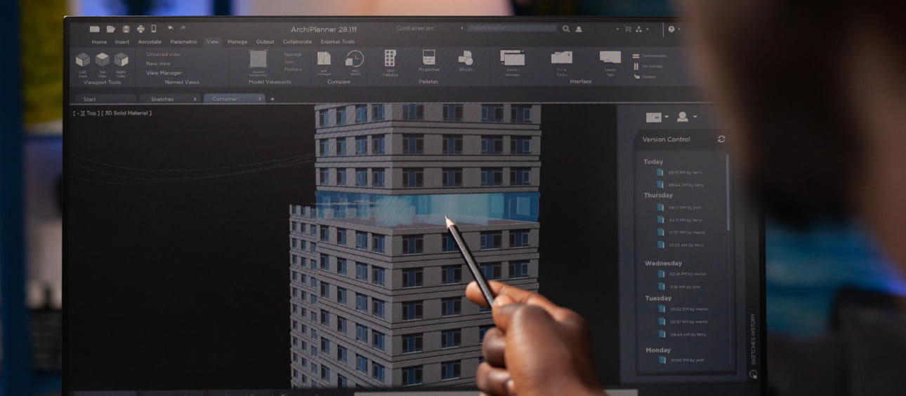
Our LiDAR Scanning process follows a systematic methodology refined through extensive project experience. The process begins with detailed scanning planning that establishes project requirements, accuracy needs, deliverable expectations, and logistical parameters. Site preparation includes control point establishment, access coordination, and area preparation to optimize scanning conditions. The on-site scanning phase employs appropriate equipment and scan density settings to capture comprehensive spatial data with scan station positions strategically planned for complete coverage and minimal occlusions. For complex projects, we supplement standard scanning with targeted high-resolution scans of critical areas and specialized capture of challenging elements. Post-processing begins with systematic registration of individual scans using control points, overlap features, and advanced alignment algorithms to create a unified point cloud dataset. Quality verification includes registration accuracy assessment, coverage validation, and data integrity confirmation. The final processing phase optimizes the point cloud through noise reduction, classification, and segmentation while preparing appropriate data formats for downstream applications including BIM modeling, documentation, and analysis.
We employ industry-leading scanning equipment and processing technologies tailored to specific project requirements. Our primary scanning systems include terrestrial laser scanners from manufacturers including Leica, FARO, and Trimble with specifications selected based on project needs, accuracy requirements, and environmental conditions. These systems are supplemented by specialized capture tools including handheld SLAM-based mobile scanners for confined spaces, drone-mounted LiDAR for exterior and roof documentation, and photogrammetric systems for texture capture. Positioning technologies including total stations, GNSS receivers, and control networks support accurate georeferencing and alignment with existing coordinate systems. Our processing ecosystem includes industry-standard software platforms such as Leica Cyclone, FARO Scene, and Autodesk ReCap Pro for registration and basic processing, complemented by specialized tools including CloudCompare, Pointfuse, and proprietary solutions for advanced point cloud analysis, feature extraction, and deliverable generation. This comprehensive technology approach ensures optimal data capture and processing regardless of project complexity or environmental challenges.
Our LiDAR Scanning services produce versatile deliverables tailored to project requirements and downstream applications. Standard deliverables include registered point cloud data in industry-standard formats (E57, PTX, RCP, LAS) with appropriate organization, classification, and metadata. For direct visualization, we provide web-based point cloud viewers, virtual tour navigation systems, and interactive panoramic images that allow stakeholders to explore captured spaces without specialized software. Measurement-focused deliverables include dimensioned floor plans, sections, elevations, and 3D models at various levels of detail derived from scan data. For BIM integration, we offer scan-to-BIM conversion services or prepared scan data optimized for modeling workflows. Specialized deliverables include mesh models, surface reconstructions, deviation analysis, clearance reports, and volume calculations based on specific project needs. All deliverables are provided with appropriate documentation including accuracy reports, coverage maps, metadata, and usage guidelines to ensure effective utilization of the captured data throughout the project lifecycle.
LiDAR Scanning provides foundational reality data that integrates seamlessly with BIM and design workflows through established interoperability pathways. For direct reference methods, properly prepared point clouds are imported into design platforms including Revit, ArchiCAD, and AutoCAD providing an accurate spatial context for new design work. This reference approach enables designers to create new elements with confidence that they properly align with existing conditions. For conversion workflows, scan data supports accurate BIM modeling of existing elements through either manual modeling with point cloud reference or semi-automated scan-to-BIM processes that accelerate existing condition modeling. Hybrid workflows maintain point clouds for some elements while modeling others based on project priorities and requirements. Throughout design development, scan data supports continuous verification of design compatibility with existing conditions, clash prevention between new and existing elements, and optimization of system routing through accurately documented spaces. For construction implementation, scanning enables precise prefabrication, installation planning, and field verification that ensures successful integration of new elements within existing conditions.
LiDAR Scanning delivers transformative advantages over traditional measurement approaches across multiple dimensions. Comprehensiveness represents a primary benefit, with scanning capturing all visible surfaces simultaneously rather than selective point measurements, resulting in complete spatial documentation rather than limited sampling. Accuracy benefits include millimeter-level precision, consistency across large areas, and elimination of cumulative measurement errors that plague manual methods. Efficiency improvements are substantial with scanning documenting entire facilities in days rather than weeks required for manual measurement, while capturing significantly more information. Risk reduction occurs through non-contact documentation that eliminates safety hazards associated with accessing difficult areas, while creating comprehensive records before intervention begins. Long-term value emerges through creation of permanent digital records that support multiple future applications beyond initial project needs. Additional benefits include reduction of return site visits through complete initial capture, objective documentation that eliminates interpretation errors, and superior visualization capabilities that enhance understanding of complex spaces. These combined advantages make LiDAR Scanning the optimal approach for documenting existing conditions across virtually all project applications.
Wide Range of SERVICES
Other Scanning Services
Explore our advanced scanning and reality capture services that create accurate digital representations of existing buildings and sites for renovation and documentation.
Transform 3D point cloud scan data into accurate BIM models of existing buildings, capturing as-built conditions with precision and detail.

Document existing buildings and facilities through comprehensive as-built drawings and models based on field measurements or scan data.

Create accurate digital representations of existing buildings, components, or systems where original documentation is unavailable or outdated.