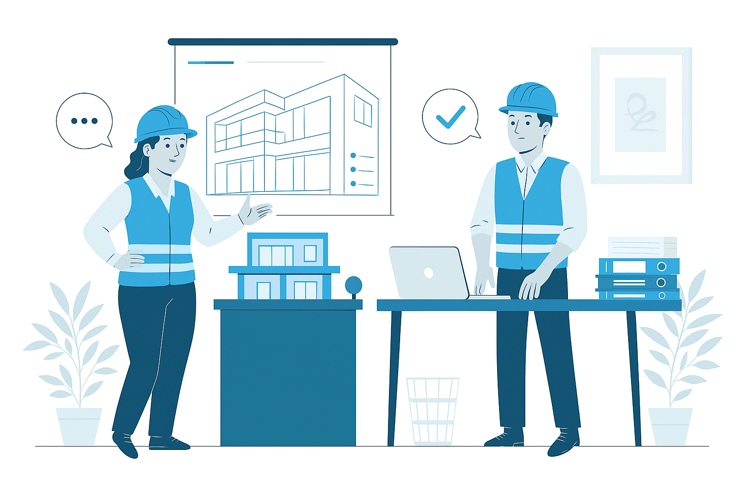
Underground Utility Modeling
Underground Utility Modeling Services
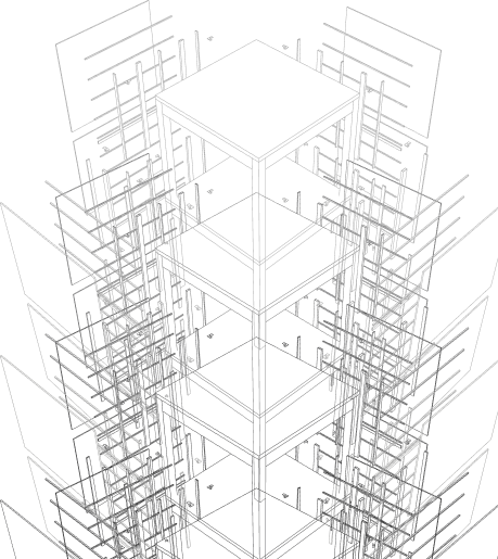
In modern construction and infrastructure development, comprehensive underground utility modeling has become essential for managing the complex network of subsurface systems that support our built environment. Our specialized underground utility modeling services create detailed 3D representations of buried infrastructure including water, sewer, stormwater, power, and communications networks with accurate spatial positioning and system properties. These models provide critical subsurface understanding that minimizes utility conflicts, prevents service disruptions, improves construction safety, and enhances overall project outcomes by addressing underground challenges before excavation begins.
Subsurface Infrastructure
- Comprehensive 3D modeling of subsurface utility infrastructure and buried systems
- Accurate horizontal and vertical positioning based on available utility information
- Conflict detection between underground utilities and structural elements
- Proper utility classification with confidence ratings based on verification methods
- Detailed component representation with material properties and system relationships
Comprehensive Underground Infrastructure Modeling
Our underground utility modeling services implement a systematic approach that develops detailed digital representations of subsurface infrastructure systems. We begin with comprehensive data acquisition from utility records, as-built documentation, field investigations, and specialized detection methods to establish the most accurate understanding of existing conditions. Based on available information, we create detailed utility models with proper horizontal positioning, vertical depth, component dimensions, and system relationships that reflect the subsurface environment with appropriate confidence classifications.
Each utility system receives specialized modeling treatment with system-specific components, proper identification, and technical parameters based on available information and project requirements. Throughout development, our coordination processes identify potential conflicts between different underground systems and with structural elements including foundations, underground structures, and below-grade building components. Quality verification confirms model accuracy according to source information reliability, investigation methods, and field verification with appropriate confidence ratings that clearly communicate information reliability. The completed underground utility models provide comprehensive digital representation of subsurface infrastructure with proper system classification, component properties, and spatial relationships supporting both construction risk management and long-term infrastructure documentation. This integrated approach transforms traditional utility information into intelligent subsurface models that substantially improve underground awareness, enhance construction safety, and reduce utility-related risks throughout project implementation.
Strategic Benefits of Underground Utility Modeling
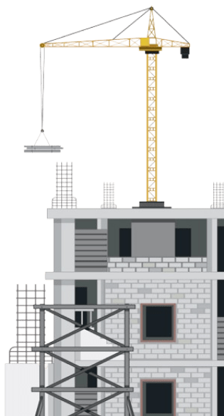
Implementing comprehensive underground utility modeling delivers substantial advantages throughout project planning, risk management, construction implementation, and long-term operations. The primary benefit comes through proactive conflict identification, where 3D modeling reveals potential clashes between different utility systems and with structural elements before construction begins. This advanced coordination prevents costly utility strikes, emergency relocations, and service disruptions that create significant financial, schedule, and safety impacts when discovered during excavation activities.
During project planning, detailed subsurface understanding enables optimized foundation design, appropriate utility protection measures, and installation phasing strategies that accommodate existing infrastructure while maintaining service continuity. For construction implementation, the comprehensive utility models support improved excavation planning, enhanced crew awareness, and specialized procedures in high-risk areas that collectively improve both safety performance and schedule reliability. These capabilities typically reduce underground utility damage incidents by 50-70%, decrease utility-related change orders by 40-60%, and significantly improve construction efficiency compared to projects without comprehensive subsurface modeling. Beyond construction completion, accurate subsurface documentation provides valuable reference information for infrastructure management, maintenance operations, and future modifications that extends these benefits throughout the entire project lifecycle, delivering significant value from initial planning through long-term operations.
Applications of Underground Utility Modeling
Urban Redevelopment Projects
Comprehensive underground utility modeling for urban renewal, downtown revitalization, and city center projects with complex subsurface infrastructure and limited documentation. Our urban modeling addresses decades of underground infrastructure development, abandoned systems, undocumented modifications, and complex utility ownership with appropriate investigation and documentation. These detailed models support the significant excavation challenges, utility preservation requirements, and service continuity demands necessary for successful implementation of these complex urban construction projects.
Transportation & Infrastructure
Specialized underground utility modeling for highways, street reconstruction, transit facilities, and transportation corridors with extensive subsurface crossings and relocations. Our transportation modeling addresses utility conflicts, protection requirements, relocation strategies, and construction phasing with appropriate investigation and coordination. These detailed models support the complex utility adjustments, service preservation, and installation sequencing necessary for successful implementation of these linear infrastructure projects with minimal service disruption.
Campus & Healthcare Facilities
Detailed underground utility modeling for university campuses, medical centers, government complexes, and institutional facilities with extensive private utility systems and critical service requirements. Our campus modeling addresses comprehensive utility networks, service redundancy, maintenance access, and future expansion with appropriate investigation and documentation. These detailed models support both current construction activities and long-term infrastructure management while ensuring service reliability, operational continuity, and efficient maintenance throughout these complex institutional environments.
Industrial & Process Facilities
Comprehensive underground utility modeling for manufacturing plants, industrial complexes, process facilities, and production installations with specialized subsurface infrastructure. Our industrial modeling addresses process piping, chemical systems, specialized services, and critical utilities with appropriate investigation and safety protocols. These detailed models support the precise excavation requirements, hazardous material considerations, and operational continuity demands necessary for successful construction and maintenance activities within these complex industrial environments.
Why Choose Us
Advanced Underground Utility Modeling Services That Reduce Construction Risk
01
Expert Team
Certified BIM specialists with extensive experience across architectural, MEP, and facade modeling projects
02
Comprehensive Services
End-to-end BIM solutions from initial modeling to coordination, documentation, and facility management
03
Quality Assurance
Rigorous quality control processes ensuring clash-free models, accurate documentation, and seamless collaboration
04
Dedicated Support
Responsive team available to assist throughout your project lifecycle, ensuring timely solutions and continuous assistance


Know More
Frequently Asked Questions
Underground Utility Modeling is the specialized process of creating detailed 3D digital representations of subsurface infrastructure systems including water, sewer, stormwater, power, communications, and specialized service networks that exist beneath the ground surface. Unlike traditional 2D utility documentation that merely shows approximate horizontal locations, underground utility modeling creates comprehensive spatial representations with accurate horizontal positioning, precise vertical depths, component dimensions, and system relationships. This approach has become increasingly critical as projects face growing subsurface complexity, limited space allocation, and significant consequences for utility conflicts and damage. Effective underground utility modeling enables early identification of spatial conflicts between different utility systems and with structural elements, preventing costly emergency relocations, service disruptions, and safety hazards that typically occur when conflicts are discovered during construction. Industry studies show that projects implementing comprehensive underground utility modeling experience 60-80% fewer subsurface conflicts, 30-40% reduced utility damage incidents, and significant improvements in both construction safety and schedule reliability. Beyond conflict avoidance, underground utility modeling supports critical functions including capacity verification, accessibility planning, phased construction sequencing, and future expansion provisions that collectively enhance both initial construction and ongoing operations throughout the infrastructure lifecycle.
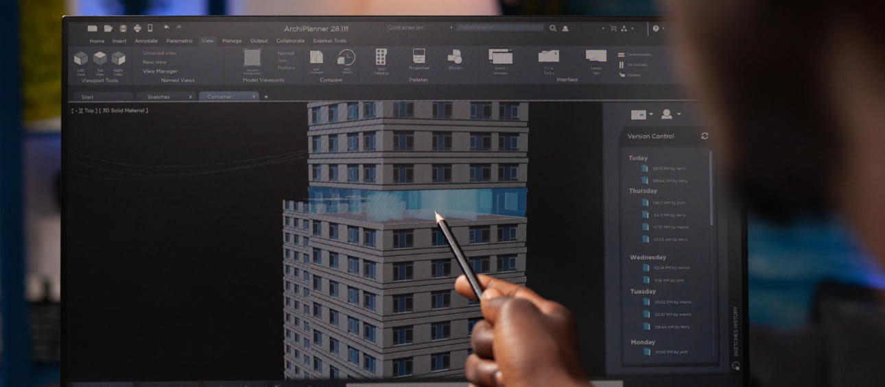
Our underground utility modeling process follows a structured methodology that systematically develops comprehensive digital representations of subsurface infrastructure. We begin with extensive data acquisition, collecting information from utility records, as-built documentation, field locates, ground-penetrating radar surveys, and potholing investigations to establish the most accurate understanding of existing conditions. Initial planning establishes modeling protocols, level of accuracy requirements, and utility classification systems based on project complexity and construction risk factors. The modeling development proceeds through progressive phases starting with primary utility systems and major components before addressing distribution networks, service connections, and specialized elements. For each utility type, detailed component modeling incorporates accurate horizontal positioning, verified depth information, proper dimensions, material properties, and system connectivity. Spatial coordination identifies potential conflicts between different utility systems and with structural elements including foundations, underground structures, and deep infrastructure. Throughout development, quality verification confirms horizontal accuracy, vertical positioning, component representation, and system continuity based on available information and field verification. Confidence ratings are assigned to different utility elements based on source information reliability, verification methods, and potential variability to support appropriate risk management during construction. The completed underground utility models incorporate proper identification, system classification, and technical parameters supporting both construction planning and conflict mitigation. This systematic approach ensures all underground infrastructure elements receive appropriate development while maintaining information integrity and accuracy classification throughout the subsurface environment.
Our underground utility modeling services address comprehensive subsurface infrastructure systems with appropriate detail and technical content based on available information. For water distribution, we model potable water mains, service lines, valves, hydrants, meters, and specialized components with accurate dimensions and material specifications. Sanitary sewer systems include gravity mains, force mains, laterals, manholes, cleanouts, lift stations, and connection points with proper slope characteristics and depth requirements. Stormwater infrastructure encompasses collection pipes, structures, infiltration systems, detention facilities, and outfall connections with appropriate capacity parameters. Electrical distribution includes ductbanks, direct-buried cables, manholes, vaults, transformers, grounding systems, and service connections with proper dimensions and clearance requirements. Telecommunications modeling addresses conduit systems, cable pathways, vaults, handholes, service entrances, and distribution infrastructure with appropriate sizing and separation specifications. Energy systems include natural gas, steam, hot water, chilled water, and fuel lines with proper trench configurations and safety clearances. Specialized utilities address fire protection, irrigation systems, industrial process piping, pneumatic networks, and other project-specific infrastructure with appropriate technical parameters. For transportation projects, related subsurface elements including drainage structures, culverts, underdrain systems, and subsurface conduits receive proper modeling with accurate positioning and dimensions. Each utility system is modeled with available information regarding horizontal location, vertical depth, component dimensions, and system characteristics while maintaining appropriate confidence classifications based on verification methods and data reliability throughout the underground infrastructure environment.
Underground utility modeling delivers substantial risk reduction and cost benefits through comprehensive spatial coordination and enhanced subsurface understanding. The primary risk mitigation comes through proactive conflict identification, where 3D modeling reveals spatial clashes between different utility systems and with structural elements before construction begins. This advanced coordination prevents costly utility strikes, emergency relocations, and service disruptions that create significant financial, schedule, and safety impacts when discovered during construction. Industry studies indicate that utility damage incidents typically cost between $4,000-$50,000 per occurrence depending on utility type, with high-risk utilities like gas or high-voltage electrical potentially exceeding $250,000 per incident when considering all direct and indirect costs. Beyond direct damage prevention, utility modeling enables optimized foundation design, appropriate protection measures, and installation phasing strategies that accommodate existing infrastructure while maintaining service continuity. For new utility installation, the comprehensive subsurface understanding supports improved routing strategies, appropriate separation clearances, and optimized trench configurations that enhance both installation efficiency and long-term operational performance. These capabilities combine to reduce typical underground construction contingencies by 15-25%, decrease change orders related to subsurface conditions by 30-50%, and significantly improve schedule reliability compared to projects without comprehensive utility modeling. By identifying and addressing subsurface challenges during the planning phase rather than during excavation, underground utility modeling delivers substantial cost savings, risk reduction, and safety improvements throughout construction implementation while minimizing impacts to existing infrastructure operations.
Our underground utility models provide tailored detail levels calibrated to available information, project requirements, and risk factors across different subsurface systems. For horizontal positioning, models incorporate accurate planimetric locations based on survey data, utility locates, or record information with appropriate accuracy classification ranging from approximate zone representation to precise survey-grade positioning depending on verification methodology. Vertical positioning includes depth information, invert elevations, or clearance dimensions derived from as-built records, potholing verification, or geophysical investigation with proper confidence ratings based on information source reliability. Main distribution elements including pipes, ductbanks, and conduits incorporate accurate sizing, material specification, and system classification with appropriate dimensional representation and burial configuration. Access structures including manholes, vaults, valve boxes, and inspection points receive detailed modeling with proper dimensions, internal configurations, rim elevations, and connection orientations when information is available. Connection points and service interfaces include tap locations, lateral positions, and transition elements with appropriate technical details and property boundaries. For high-risk utility crossings and congested corridors, enhanced detail includes specific protection requirements, crossing configurations, and verified clearance dimensions with appropriate construction notes and special provisions. The appropriate detail level for each utility system is established through systematic analysis of available information, construction methodology, and operational requirements, ensuring models provide necessary subsurface understanding while maintaining appropriate confidence classifications based on information reliability. Throughout all development, models maintain proper system identification, material properties, and technical parameters that support comprehensive underground infrastructure management beyond simple spatial representation.
Our underground utility modeling implements multiple technologies and diverse information sources to develop the most comprehensive and accurate subsurface representation possible. For existing documentation, we utilize utility record drawings, as-built documentation, GIS databases, facility management systems, and historical construction documents with appropriate verification and confidence classification. Field investigation technologies include traditional utility locating with electromagnetic equipment, ground penetrating radar surveys, and acoustic detection systems that provide non-destructive subsurface information with appropriate accuracy limitations. Physical verification methods incorporate vacuum excavation, test pits, potholing investigations, and exploratory trenching that provide direct visual confirmation of critical utility locations, depths, and characteristics. Survey technologies capture precise positioning of surface features, utility markers, access structures, and verified utility points using robotic total stations, GPS equipment, and traditional surveying methods with appropriate control networks and coordinate systems. Subsurface utility engineering protocols (ASCE 38-02 standards) establish consistent quality level classification ranging from Quality Level D (record information) through Quality Level A (exposed and surveyed) that clearly communicate reliability for each utility element. For modeling development, we implement specialized software including AutoCAD Civil 3D, Revit MEP, Infraworks, and dedicated utility modeling platforms with appropriate object libraries, classification systems, and metadata structures. Coordination and conflict detection utilize specialized clash analysis tools, clearance verification systems, and visualization platforms that identify potential issues with appropriate risk assessment protocols. These technologies and information sources are continuously evaluated and updated to incorporate emerging capabilities including AI-enhanced utility recognition, mobile mapping integration, and advanced geophysical techniques that improve both information quality and modeling accuracy throughout the underground infrastructure environment.
Our underground utility models provide comprehensive support for construction planning and field implementation through detailed subsurface visualization and strategic risk management. For excavation planning, models define high-risk zones, utility congestion areas, and critical crossing points that require specialized approaches, enhanced protection, or modified construction methods to prevent damage and service disruption. Sequence optimization utilizes subsurface understanding to establish logical construction order, dependency relationships, and phasing requirements that maintain service continuity while accommodating utility constraints. Protection planning identifies utilities requiring special consideration including vibration monitoring, support systems, hand excavation zones, or temporary relocation with appropriate methods and responsibility assignments. For new utility installation, models support precise route planning, appropriate separation clearances, and depth requirements that comply with regulatory standards while avoiding existing infrastructure conflicts. Construction teams receive enhanced visualization through cross-section views, profile drawings, and 3D representations that clearly communicate complex subsurface arrangements at critical locations. During field activities, augmented reality applications and digital field tools enable crews to visualize hidden infrastructure within the physical environment, substantially improving spatial awareness and damage prevention practices. Quality verification protocols utilize model-based documentation to confirm proper utility location, protection implementation, and installation compliance through digital comparison with design requirements. These comprehensive capabilities transform underground utility models from simple reference information into strategic construction resources that substantially improve excavation safety, reduce infrastructure damage, and enhance overall project outcomes from initial planning through final implementation.
Our underground utility models provide substantial long-term value through comprehensive subsurface documentation that supports operations, maintenance, and future development throughout the infrastructure lifecycle. The primary operational benefit comes through accurate as-built recording, where models document precise utility locations, component specifications, and system configurations that support future access, maintenance planning, and service operations. This location accuracy typically reduces utility location costs by 40-60% and improves service response times by 30-40% compared to traditional documentation methods. For system management, models provide detailed inventory of all underground components including type, size, material, installation date, and depth information that support comprehensive asset management, deterioration modeling, and replacement planning. When maintenance requirements arise, models provide detailed understanding of affected infrastructure, adjacent utilities, access methods, and excavation requirements that improve maintenance planning and minimize collateral damage during repairs. For system expansions, models establish clear understanding of existing conditions, available corridors, capacity limitations, and connection points that support efficient planning and implementation of infrastructure modifications. During property development, the subsurface understanding prevents accidental encroachment on utility easements, identifies service connection locations, and guides appropriate building placement to accommodate existing infrastructure. Throughout long-term operations, these capabilities significantly improve maintenance efficiency, reduce accidental damage, and enhance overall infrastructure reliability while providing valuable reference information for future development, renovation, and system upgrades. The comprehensive digital representation created through underground utility modeling delivers continuing value long after initial construction, supporting effective infrastructure management throughout the complete system lifecycle.
Wide Range of SERVICES
Other Infrastructure Services
Explore our comprehensive infrastructure modeling services that support planning, design, and construction of complex civil and site development projects.
Apply BIM methodologies to infrastructure projects including roads, bridges, utilities, and site development for improved coordination and delivery.

Develop detailed 3D models of landscape elements including terrain, vegetation, hardscape, and site amenities for visualization and coordination.

Create detailed Civil3D models for site development, grading, drainage, utilities, and infrastructure components with precision and accuracy.